| V I S U A L I Z Z A D I S C U S S I O N E |
| davidov |
Inserito il - 31 ottobre 2012 : 18:36:30
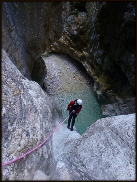
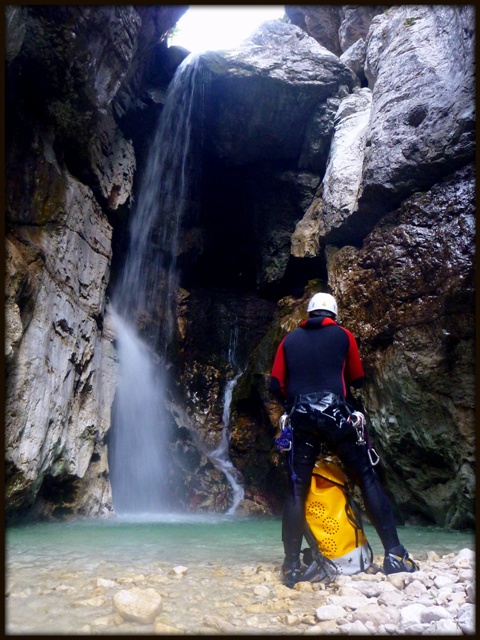
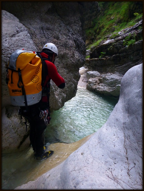
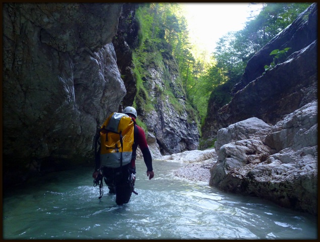
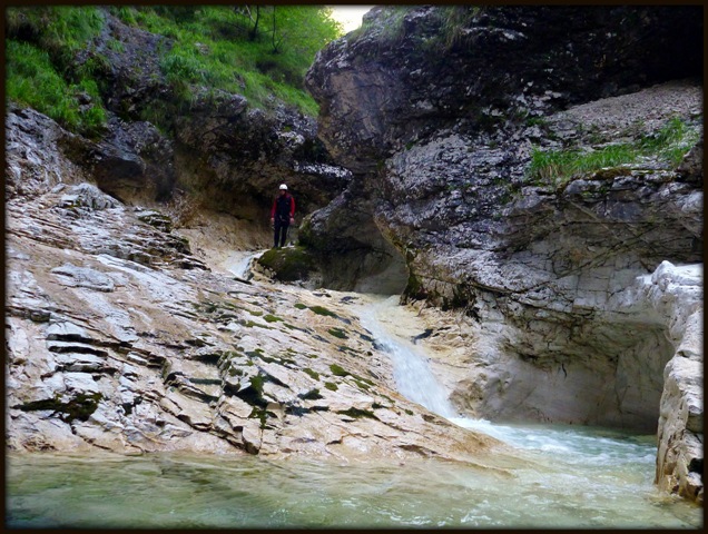
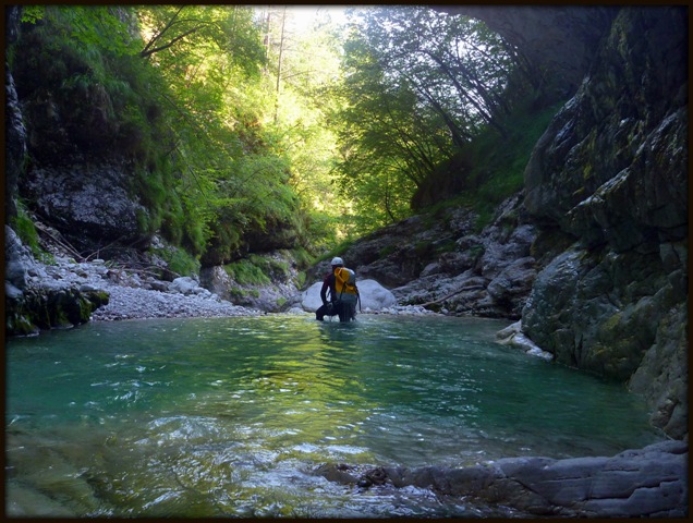
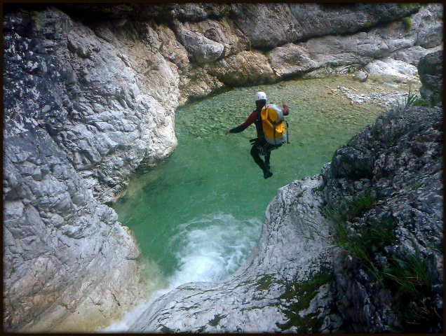
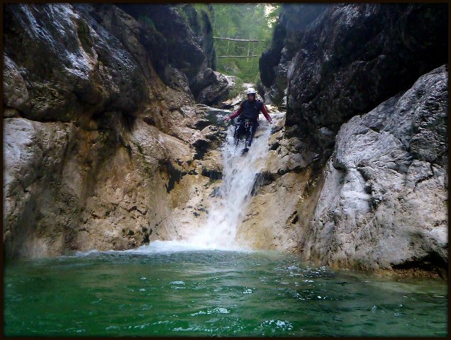
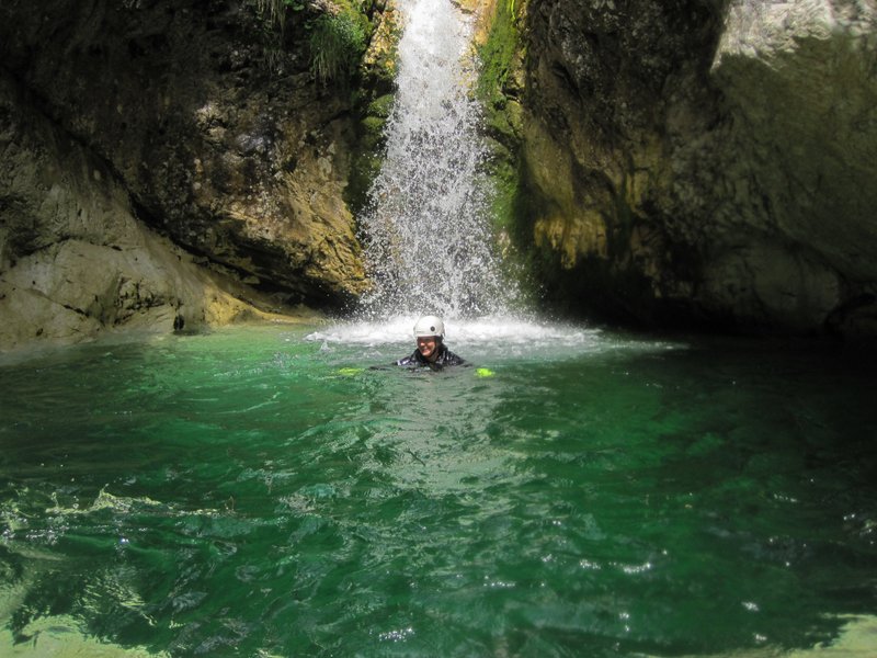
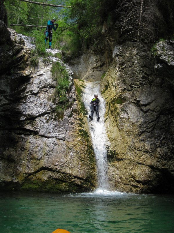
On Sunday, 5th of August, we went to Rio Ronc in Val Resia. We got the information on AIC catastre. We had some problems with the approach. It is nice canyon, quite short (just one/two rappels), with some beautiful jumps and slides. The highest jump is 10m. It would be interesting to know what is higher up in the canyon... maybe project for the next visit ;)
Photos:
Immagine:
155,26 KB
Immagine:
152,37 KB
Immagine:
145,1 KB
Immagine:
145,84 KB
Immagine:
156,51 KB
Immagine:
138 KB
Immagine:
111,25 KB
Immagine:
98,39 KB
More photos and video on:
http://www.facebook.com/CanyoningCultSlovenia
Canyoning Cult Slovenia (David Sefaj, Urska Bricelj) |
| 10 U L T I M E R I S P O S T E (in alto le più recenti) |
| Horst |
Inserito il - 07 agosto 2022 : 19:57:36
We visited Rio Ronc on the 30th of July. All rappels are well equiped. A lot of fixed ropes are currently in their. |
| CanyonEast |
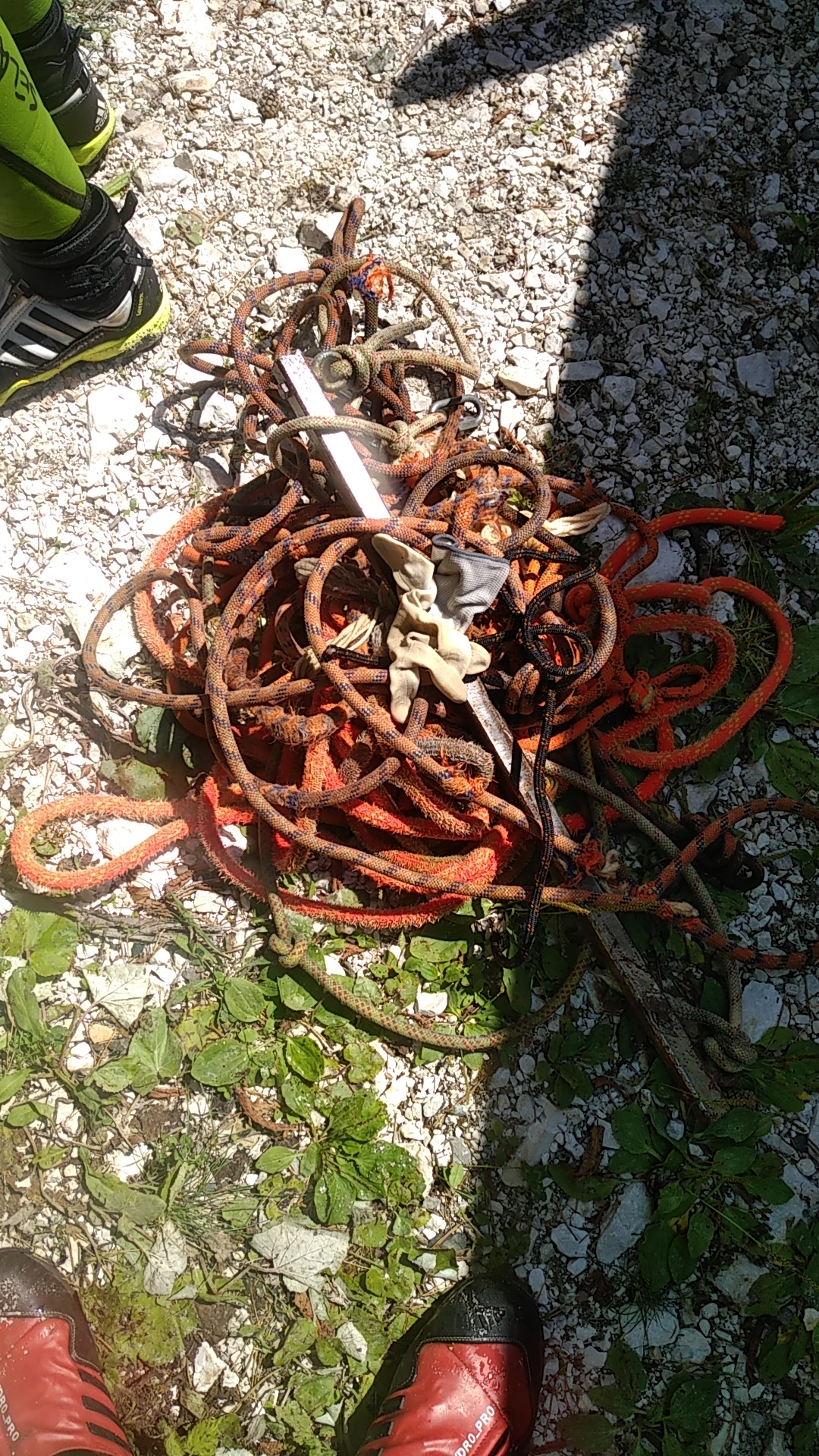
Inserito il - 07 agosto 2020 : 16:26:08
Percorso venerdì 07/08 da Canyoneast + Luca e Carla.
Sistemato ancoraggi ed eliminato tutto quello che era inutile e superfluo, soprattutto le innumerevoli corde fisse marce piazzate sulle ultime calate.
Messa una nuova corda fissa per agevolare la risalita per l'ultimo tuffo.
!ATTENZIONE!
Rio Ronc nei prox 10/15 gg la strada forestale di accesso non sarà transitabile con le auto, in quanto stanno rifacendo la base del primo guado. Le auto dovranno essere lasciate sulla strada principale per poi proseguire a piedi
http://www.canyoneast.it/
Immagine:
1266,71 KB |
| bagira16 |
Inserito il - 03 agosto 2020 : 11:26:53
Percorso 1/8 dopo Macile. Portata normale, nel ancoraggio della "grande" calate mancava il cordino con il maillone, così punto alto, scomodo. |
| CanyonEast |
Inserito il - 20 luglio 2020 : 12:19:23
Percorso sabato 18/07 da Canyoneast
Tutti gli armi ok
tutte le pozze tuffabili tranne il 16 che è inghiaiato
Molte corde fisse dei commerciali, e nuovi armi posizionati in posti assurdi e inutili
http://www.canyoneast.it/ |
| bagira16 |
Inserito il - 10 dicembre 2018 : 16:20:16
Percorso domenica 09/12/18 da 5 ungheresi, nessun problema con l'avvicinamento, tutti gli ancoraggi a posto, tutti tuffi fattibili. Anche la pozza della calata 20m era abbastanza grande e profonda, i temporali e la piena l'ha pulita, e ha construito un diga. Nella parte ultima, dove c'e solo camino e il sentiero, ci sono i segni del tempaccio precedente e della piena, c'eranno piccole frane, una ha portata via alcuni merti del sentiero, e c'e tante detritto, ma nessun pericolo, nessun problema.
Probabilmente le guide nella meta, dove un mancorrente a sinistra per fare un tuffo piu alto, hanno constriuto una dondola, per slancarsi e tuffare nella pozza. |
| seba |
Inserito il - 12 ottobre 2014 : 16:33:56
Percorso sabato 12 da CanyonEast e CanyonCultSlovenia.
Abbiamo trovato la forra completamente riattrezzata,ed abbiamo provveduto ad eliminare I vecchi ancoraggi ancora in loco (?) Le pozze sono quasi tutte inghiaiate ed I toboga ed I tuffi fattibili sono pochissimi.
portata intorno ai 20 l/s.
Per l avvicinamento prcheggiare prima del secondo guado quindi continuare sulla strada forestale fino a trovare le indicazioni del sentiero CAI. Dopo circa 20' di cammino un evidente traccia abbandona il sentiero CAI ,(poco dopo un albero con segnavia CAI).Seguirla fino ad un ghiaione che sceso conduce all inizio dell itinerario
avvicinamento 40'
discesa 50'
rientro 5'
byez Seba
Broili Sebastiano
C.R Friuli Venezia Giulia
friuliveneziagiulia@aic-canyoning.it
348 6965069
CanyonEast
https://www.facebook.com/groups/106940946001143/
LINK AL CATASTO AIC
http://catastoforre.aic-canyoning.it/index/regioni |
| davidov |
Inserito il - 23 luglio 2013 : 10:22:17
With Urska We also went down this path in to the canyon.
davidov |
| gebu |
Inserito il - 22 luglio 2013 : 23:23:17
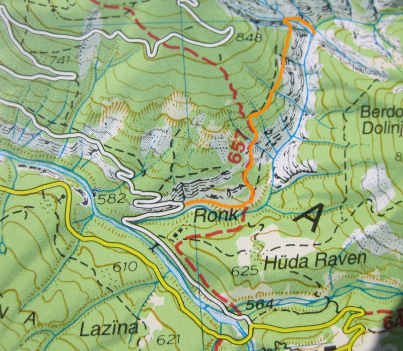
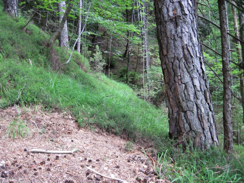
This weekend we were in Rio Ronc. When I first went into this canyon I used an approach on the eastern side of the valley which was quite horrible.
Hannes Holzer posted his approach on the western side of the valley to the canyoningwiki which was much nicer.
Immagine:
200,74 KB
Follow the marked path until you reach a place where the path turns left and a faint trail starts at a tree.
Immagine:
248,57 KB
The path soon crosses a dry creekbed and traverses the mountain. When you reach the upper end of the canyon, turn left (some bushes) and cross into a side creek. Climb down this sidecreek until you reach Rio Ronc just at the beginning of the canyon.
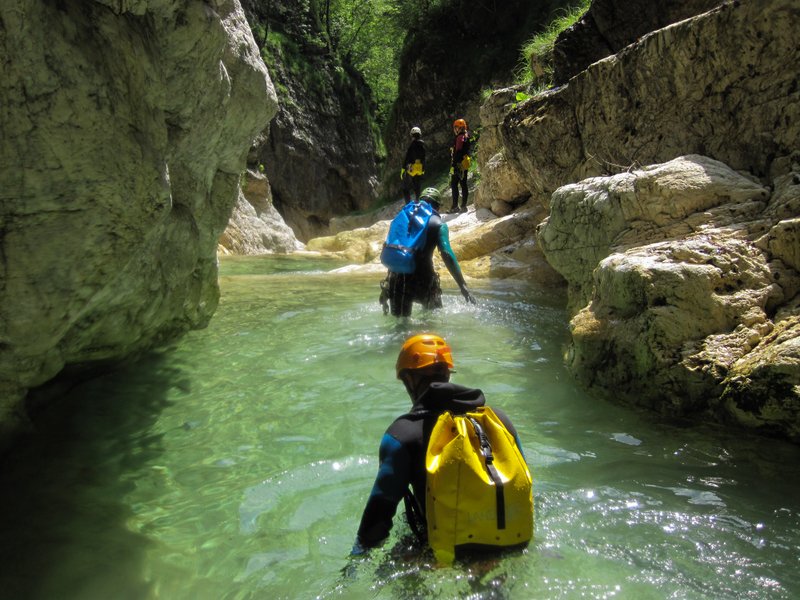
Inside the canyon everything was perfect - sunny weather, white rocks and deep pools.
Immagine:
158,65 KB
Immagine:
143,2 KB
Immagine:
193,94 KB |
| davidov |
Inserito il - 16 maggio 2013 : 20:59:07
On Tuesday, 14th of May we explored the upper part of Rio Ronc (Ronek). The approach was very difficult, we came to the spring of the creek, we rappeled 10m, afterwards we just walked all the way down to the normal access path.
The waterlevel was quite high, pools are now deep enough to do all the jumps.
Canyoning Cult Slovenia |
| david |
Inserito il - 31 ottobre 2012 : 20:12:06
hy david!!your question it was our question during the exploration......
if you have had problem to the approach of the lower part probably the highest is definetly worst(probably,of course!).no path in the map but ,always probably,the local hunter and mountain man know the right way to reach the highest part(alive ,better !). !).
without this knowledge could be a real challenge!
the creek is big and the bacin is great.the drop is good and a exploration upstairs could be interesting...
could be a good idea look for a way during the bad season without exploration set on the backpack....(no warm,less ticks,no lies on the trees)
if you try let me know!!!i'm really curiose and,if it's possible ,i would like partecipate to the exploration trip.
i have this idea but i live too far away from there and i have too much projects with few time,so sometimes i lose some good occasion......
have a nice time! |
|
|


